
Florida Public Radio Emergency Network (FPREN) Storm Center | By Irene Sans
We are monitoring a tropical wave located over 2,500 miles away from South Florida. The National Hurricane Center gives it a medium chance to develop once it moves closer to the Greater Antilles late this week.
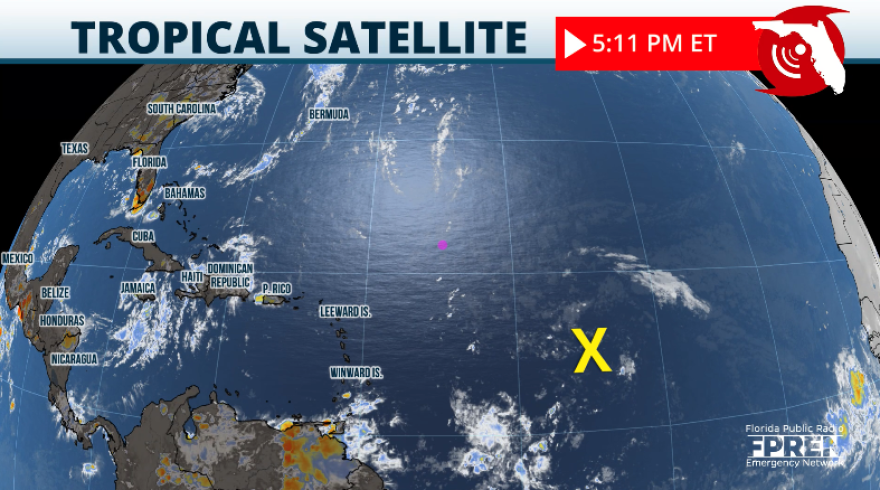
If you are looking for a robust tropical wave on the satellite, it just doesn’t exist yet. If you are looking at the latest satellite imagery from the tropical Atlantic you would have trouble spotting this system out on Tuesday afternoon. There is plenty of dry air around it, choking any chance for development in the short term. The area of disturbed weather is traveling mainly west, and it is located about 900 miles west of Barbados in the Lesser Antilles. This area will interact with a tropical wave which will give it an oomph, allowing thunderstorms to form. As thunderstorms form and try to become more organized this system will be approaching the northeastern Caribbean during the middle of the week and once it is over the vicinity of the Hispaniola, is when conditions become more favorable for this system to acquire a defined circulation and be better organized. Currently, there is a 50 percent chance of development late this week.

It is more likely for this system to develop over the Bahamas if it stays further away from the Hispaniola. The Dominican Republic has the tallest mountain of the Caribbean and if this system were to dissect the Hispaniola it would be going through rough terrain which could prevent it from developing. If this system stays well north of the Caribbean, the islands along the way are flatter and there is more water involved that would aid development.
Residents in Florida need to monitor this wave and its evolution. Also, residents in the Southeastern Atlantic coast, from Florida through the Carolinas as systems with his track history tend to turn northward. Then it would depend on its proximity to the coast if any significant impacts will be felt.
Overall, the semi-permanent feature known as the Bermuda High will guide this system. We can discuss different models and what they are showing, but at this point is pure speculation, as models do not grasp a realistic scenario if there is not a system with a well-defined center of circulation. As mentioned before, this system is just a broad area of disturbed weather that is very disorganized at this point and we must wait a couple more days for it to become better organized.
Nonetheless, this is a good reminder that the busiest weeks of hurricane season are almost upon us, and this is the time to check if all our documents are in order. Check your insurance policy and make sure it is up to date. Also, if you are on important medication consult with your pharmacy if you can get a 3- 3-month supply to make sure you have enough medication on hand in case a storm impacts your area. If you have a generator, make sure it works. If you are in an evacuation zone, make sure to have a plan in place and know what you would do if you were ordered to evacuate.


Leave a Reply


